Geophysics

"Imaging underground structures, otherwise assimilating it"

In 21st century, for the development of energy resources, utilization of underground spaces and preservation of the Earth's environment, we need to understand the underground structure in various scales. To solve such problems, imaging technology to visualize underground structure is quite important. For the targets that cannot be visualized, experimental and numerical approach is quite effective to assimilate the field observation data.

We are studying and developing geophysical prospecting methods to visualize the underground structure using elastic and electromagnetic waves in a non-destructive way at remote distances. For the targets such as fault friction that cannot be seen by the above methods, we conduct laboratory and numerical experiments to reproduce the phenomena observed in the nature. To archive such research targets, we need to involve the knowledge in various research field such as geology, seismology, elasticity, electromagnetics, and tribology.

Academic Staff

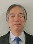
Eiichi FUKUYAMA

Professor (Graduate School of Engineering)
Fukuyama190408Research Topics

Large scale rock friction experiments and fault rupture simulation along complicated fault system have been conducted based on rock fracture mechanics and dynamics of rock friction to evaluate the strength of Earth's crust and stress applied there, whose information had been considered to be difficult to evaluate. Large scale friction apparatus is a very unique testing machine in the world. Using this apparatus, scale dependency of friction on the sliding surface size and detailed rupture front propagating along the fault have been studied. In addition, using boundary integral equation method, dynamic rupture propagation along complicated fault system can be achieved, which provides us with an information on the strength of the fault as well as the applied stress to the fault system. These may lead us to understand the evaluation of crustal rock strength.

Contacts

Room 112, Bldg. C1, Katsura Campus, 615-8540, Kyoto, Japan
TEL:+81-75-383-3209
E-mail: fukuyama.eiichi.3x@kyoto-u.ac.jp

Junichi TAKEKAWA

Junichi TAKEKAWAAssociate Professor (Graduate School of Engineering)

Research Topics

It is essential to reveal mechanical and engineering behavior of rock mass for development of earth resources, earthquake disaster prevention and global environment protection. I study failure phenomenon occur in connection with seismic wave propagation, fluid flow occur in connection with failure phenomenon by using numerical approach.

Contacts

Room 113, Bldg. C1, Katsura Campus
TEL: +81-75-383-3197
FAX: +81-75-383-3198
E-mail: takekawa@tansa.kumst.kyoto-u.ac.jp

Nana YOSHIMITSU

Assistant Professor (Graduate School of Engineering)

Research TopicsNanaYOSHIMITSU20240820.JPG

Waveform analysis of micro fractures observed during rock compression experiments and induced earthquakes accompanied with resource mining unveil the stress and heterogeneity condition of the seismogenic environment. Broadband records observed in a laboratory will make it possible to apply similar analysis technique with natural seismic events to laboratory events. Interaction between laboratory scale analysis and natural scale analysis lead a universal understanding of fracture process in a crust.

Contacts

Room 111, Bldg. C1, Katsura Campus, 615-8540, Kyoto, Japan
TEL: +81-75-383-3195 
E-mail: yoshimitsu.nana.6i@kyoto-u.ac.jp

Research Topics

Shallow subsurface survey using geophysical prospecting methods for infrastructure and geo-environment

It is not easy to delineate the geological condition and the physical properties of soil and rock even in the very shallow subsurface. Only geophysical methods can understand the 3-D distribution of underground water and contaminator in the soil from the surface as well as geological structures.

We are applying the geophysical prospecting methods to the shallow subsurface survey that is inevitable for maintaining the infrastructure and geo-environment. The application includes;

  • Prediction of a head of the tunnel face using seismic method,
  • Detection of cavities located inside the river bank using shallow S-wave reflection method,
  • Detection of buried pipes and estimation of its material properties using ground penetrating radar,
  • Monitoring soil improvement treatment and environmental remediation using geophysical methods.

Figure 1 shows an application of seismic technique to prediction of a head of tunnel face. Two seismic reflectors imaged here show the geological boundaries. Using this information, we can predict the location, direction, dip and physical properties of sudden change of geological condition, prior to excavation.

image : Geological boundaries imaged using seismic reflection survey of a head of tunnel face.
Figure 1. Geological boundaries imaged using seismic reflection survey of a head of tunnel face.
(a) Schematic, (b) the result of 3-D imaging and (c) the estimated geological boundaries.

Deep subsurface survey using geophysical prospecting methods for the exploration and the development of new energy resources

It is not too much to say that the fossil energy such as oil and natural gas does support the industrial development of the 20th and 21st centuries. Without geophysical methods, we can never explore nor develop these energy resources located deep (over several 1000 meters) inside the Earth. Three-dimensional seismic reflection technique can visualize complicated 3-D subsurface structures such as faults and folds, understand the ancient sediment environment and reveal the complete history of the sedimentation.

We are applying the geophysical methods to a new challenging target for exploring and developing new energy resources. The target includes;

  • Exploration and production monitoring of methane hydrate existing beneath the deep sea floor or the permafrost,

  • Monitoring oil sand recovery during steam injection,

  • Monitoring CO2 sequestration into coal seams and recovery and production of methane gas from the coal seams.

Figure 2 shows a 3-D data volume of subsurface structure obtained by 3-D seismic reflection method. We can extract any sections of interests and can calculate physical properties from the data volume.

image : Data volume of subsurface structure obtained by 3-D seismic reflection method.
Figure 2. Data volume of subsurface structure obtained by 3-D seismic reflection method.

Developing a high-resolution visualization technique of subsurface information (geotomography) and its application

Technologies such as X-ray CT and MRI in medical diagnostics can visualize a section or even a 3-D image of human body without cutting it. Geotomography is based on the same principle. Lots of sensors are arranged to encompass a target area. The measured data are processed by a extensive use of computers. Then we can obtain beautiful color images of the distribution of seismic velocity, attenuation characteristics and resistivity. Imaging 3-D distribution can also be possible.

We are studying geotomography techniques from the basic theory to the application to the following targets.

  • High resolution imaging of fractured zone using waveform inversion technique,
  • Monitoring the effects of environmental remediation treatment using resistivity tomography,
  • Imaging 3-D distribution of a fault zone at a dam construction site using 3-D seismic tomography.

Figure 3 shows the 3-D velocity distribution obtained by using 3-D seismic tomography. The upper figure shows the velocity distribution of the volume encompassed by the 4 boreholes. The lower figure shows the 3-D distribution of the fractured zone in a rock mass at another site.

image : 3Three-dimensional velocity distribution obtained by using 3-D seismic tomography.
Figure 3. Three-dimensional velocity distribution obtained by using 3-D seismic tomography.

Laboratory Website

http://tansa.kumst.kyoto-u.ac.jp/